Trail Mountain bike La Petite-Pierre - L'Étang du Donnenbach - La Petite Pierre - Photo

L'Étang du Donnenbach - La Petite Pierre

 tracegps
tracegps

User

© OpenStreetMap contributors
Length
Length
13.8 km
Max alt
Max alt
404 m
Uphill gradient
Uphill gradient
299 m
Km-Effort
Km-Effort  
17.8 km
Min alt
Min alt
250 m
Downhill gradient
Downhill gradient
297 m
Boucle
Boucle
Yes
Creation date :
2014-12-10 00:00:00.0
Updated on :
2014-12-10 00:00:00.0

(0 Reviews)

Mountain bike
Mountain bike
1h00
Difficulty : Difficult

Scan this QR Code to open this trail in the SityTrail application

FREE GPS app for hiking

Logo SityTrail SityTrail

IGN / Geographical institutes

Download SityTrail from the App Store Download SityTrail from Google Play

Logo SityTrail SityTrail World

The world is yours!

Download SityTrail from the App Store Download SityTrail from Google Play Download SityTrail on Huawei AppGallery

About

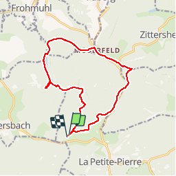
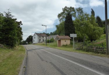
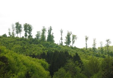
Trail Mountain bike of 13.8 km to be discovered at Grand Est, Bas-Rhin, La Petite-Pierre. This trail is proposed by tracegps.

Description

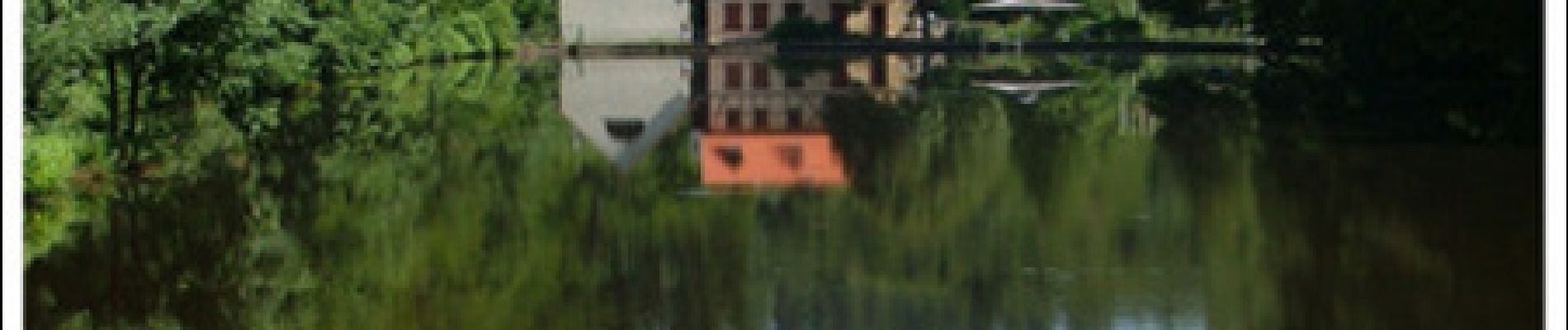
L’Étang du Donnenbach – La Petite Pierre Un circuit de la Base VTT du Pays de La Petite Pierre labellisée par la Fédération Française de Cyclotourisme. Départ du stade de la Petite Pierre. Créé au Moyen Age en vue d'une exploitation piscicole l'étang du Donnenbach a par la suite reçu une vocation hydraulique par l'installation d'une scierie et d'un moulin au XVlll's. La première habitation fut construite en 1730. Aujourd'hui, le site abrite une auberge et la Maison de l'Eau et de la Rivière qui est un centre d'initiation à la Nature et à l'Environnement. L'étang a inspiré le poète René Char entre 1939 et 1940 : « Lac de Donnenbach [...] la neige voluptueuse sur le sol des hordes fugitives de cerfs et de sangliers, était une fête aux étoiles »

Elevation profile

Photos

Positioning

Country:
France
Region :
Grand Est
Department/Province :
Bas-Rhin
Municipality :
La Petite-Pierre
Location:
Unknown
Start:(UTM)
375338 ; 5414041 (32U) N.

Trails nearby

Trail On foot La Petite-Pierre - Triangle vert - Photo
On foot
PRO

On foot

Easy
La Petite-Pierre, Grand Est, Bas-Rhin, France
15.1 km | 19.2 km-effort
4h 22min
No
Trail On foot Hinsbourg - Anneau rouge - Photo
On foot
PRO

On foot

Easy
Hinsbourg, Grand Est, Bas-Rhin, France
7.1 km | 9.9 km-effort
2h 15min
Yes
Trail On foot Zittersheim - Anneau jaune - Photo
On foot
PRO

On foot

Easy
Zittersheim, Grand Est, Bas-Rhin, France
9.5 km | 12.9 km-effort
2h 55min
Yes
Trail On foot La Petite-Pierre - Anneau bleu - Photo
On foot
PRO

On foot

Easy
La Petite-Pierre, Grand Est, Bas-Rhin, France
4.7 km | 6.8 km-effort
1h 33min
Yes
Trail On foot Dossenheim-sur-Zinsel - Croix rouge - Photo
On foot
PRO

On foot

Easy
Dossenheim-sur-Zinsel, Grand Est, Bas-Rhin, France
13.2 km | 17.1 km-effort
3h 53min
No
Trail On foot La Petite-Pierre - Triangle rouge - Photo
On foot
PRO

On foot

Easy
La Petite-Pierre, Grand Est, Bas-Rhin, France
9.6 km | 13.1 km-effort
2h 59min
No
Trail On foot La Petite-Pierre - Chevalet bleu - Photo
On foot
PRO

On foot

Easy
La Petite-Pierre, Grand Est, Bas-Rhin, France
9.8 km | 13.6 km-effort
3h 5min
No
Trail On foot La Petite-Pierre - Rectangle jaune barré de blanc - Photo
On foot
PRO

On foot

Easy
La Petite-Pierre, Grand Est, Bas-Rhin, France
3.9 km | 5.4 km-effort
1h 13min
No
Trail On foot La Petite-Pierre - Triangle bleu - Photo
On foot
PRO

On foot

Easy
La Petite-Pierre, Grand Est, Bas-Rhin, France
5.8 km | 7.5 km-effort
1h 41min
No


Close
My subscriptions